Abstract or Summary
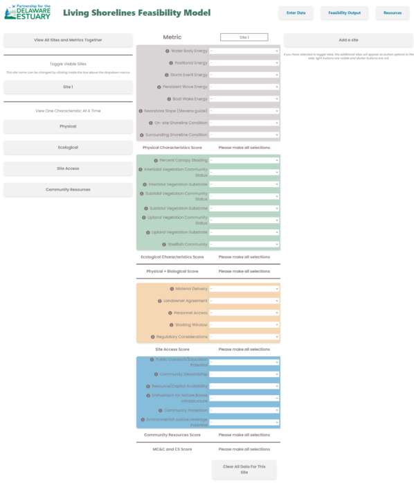
The living shoreline feasibility model (LSFM) is an integrative tool that evaluates a suite of metrics to assess considerations involved in constructing and maintaining a living shoreline at a specific location. It guides users in collecting information on the physical and ecological characteristics of a site as well as factors related to site access and community resources, which are subsequently integrated to provide baseline data on existing conditions and inform team building, design, and installation planning. The LSFM is not a landscape scanning tool, but provides a relative evaluation of sites brought to the model. For additional resources including a training video, user’s guide, and data sheets go to: https://delawareestuary.org/science-and-research/tools/